
Quick Answer
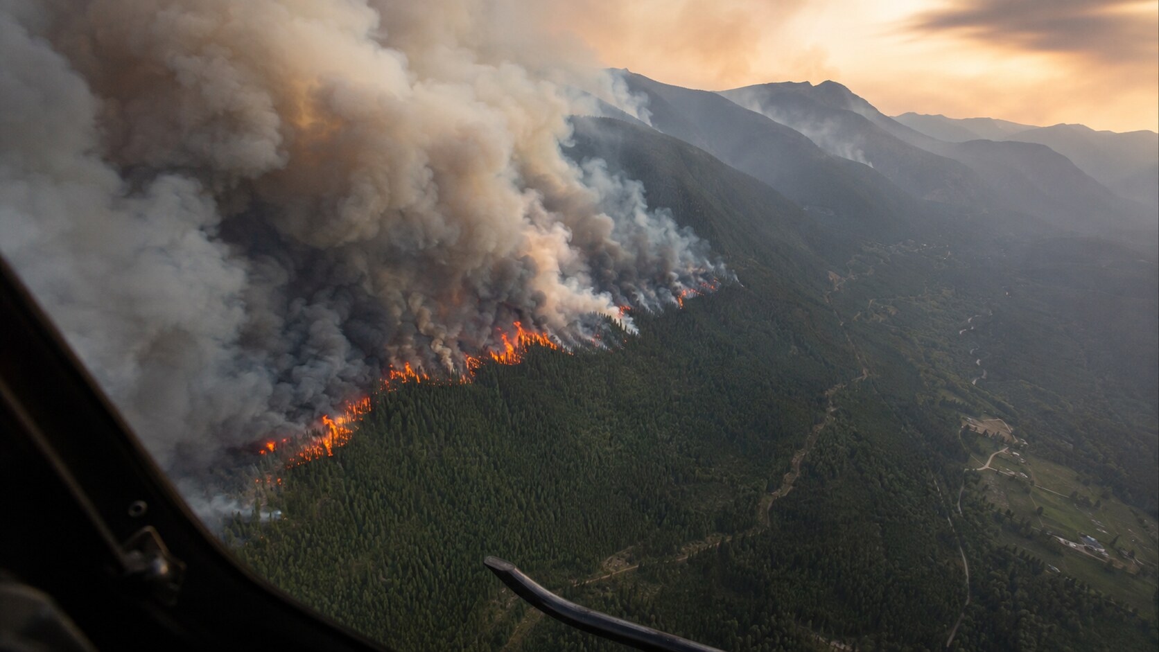
B.C. declared a state of provincial emergency on Saturday, August 8, 2026, as regional wildfires placed growing pressure on the province’s emergency response. Premier David Eby announced the declaration, which was made under the Emergency and Disaster Management Act.
The declaration followed the rapid expansion of the Bald Range wildfire into the Summerland area. Eby said homes and other structures had been lost, some people became trapped as conditions changed, and aircraft were being used to evacuate people isolated behind the fire perimeter.
Officials ordered people in affected parts of Summerland and surrounding communities to leave immediately. The province says anyone under an evacuation order is at risk and must not wait.
The evacuation boundaries, reception centres and road closures described below were current when the provincial emergency alert was issued on August 8. Conditions can change quickly, so residents should check EmergencyInfoBC, EmergencyMapBC and DriveBC before relying on this information.
Key Takeaways
- B.C. declared a state of provincial emergency on August 8 because of regional wildfires.
- The Bald Range wildfire spread rapidly toward Summerland as winds intensified.
- Officials reported significant structure loss, including homes, but had not released a confirmed total.
- Aircraft were used to evacuate people isolated behind the fire perimeter.
- Evacuation orders covered Summerland and several surrounding South and Central Okanagan communities.
- Highway 97 was closed between Antlers Beach and Pyramid Picnic Area when the provincial emergency alert was issued.
- People under an evacuation order must leave immediately and follow official routes and instructions.
A Fire That Changed Faster Than Communities Could Move
The emergency unfolded with frightening speed.
According to the premier’s statement, the Bald Range wildfire was first reported early Friday evening. As winds strengthened, the fire grew rapidly and pushed into the Summerland area, affecting communities across the surrounding valleys.
By Saturday, the situation had escalated beyond a local wildfire response. A large evacuation had taken place overnight, some residents had become trapped, and rescue teams were trying to reach people cut off behind the fire perimeter.
Eby said the province’s immediate priorities were protecting lives and supporting rescue operations. BC Wildfire Service crews, RCMP officers, first responders, emergency-management teams and local communities worked through the night as the fire threatened populated areas.
“To everyone affected, you are not facing this alone – the entire province is with you,” Eby said.
Officials reported significant structure loss, including homes, but the province had not released a verified count of destroyed structures, rescued residents or injuries in the statement. Those numbers should not be estimated while response operations remain active.
Where Evacuation Orders Were Issued
A B.C. emergency alert issued on August 8 directed people to evacuate immediately from affected areas that included:
- Summerland;
- Faulder;
- the Big Valley Road area;
- the Brent Road and Log Chute Road area south of Peachland; and
- the area from Darke Lake south to Bathville Road, including Garnet Valley Road and Princeton-Summerland Highway to kilometre 15.
The alert was issued in connection with orders from the regional districts of Okanagan-Similkameen and Central Okanagan, the District of Summerland and Penticton Indian Band.
Officials warned that the Bald Range wildfire posed a significant risk to life. Anyone unable to evacuate was instructed to call 911 and provide their exact location, along with any urgent medical or mobility needs.
Evacuation boundaries can change quickly. Residents should check their address through official local-government channels or EmergencyMapBC instead of relying on an older screenshot or social-media post.
Highway 97 Closure Complicates Escape Routes
When the emergency alert was issued on August 8, Highway 97 was closed from Antlers Beach to Pyramid Picnic Area. The alert also warned evacuees not to follow mapping applications onto forest service roads, with the stated exception of 201 Forest Service Road.
That warning matters during a fast-moving wildfire. A navigation application may calculate the shortest road without knowing whether it is blocked, unsafe or unsuitable for evacuation traffic.
People travelling in the region should check DriveBC before leaving and follow directions from RCMP officers and emergency personnel at roadblocks. They should not assume the August 8 closure limits or permitted routes remain unchanged.
Where Evacuees Were Directed to Seek Help
As of the August 8 emergency information, evacuees needing assistance were directed toward Emergency Support Services.
Reception locations listed by EmergencyInfoBC included:
- 550 Eckhardt Avenue West in Penticton; and
- Westbank Lions Community Centre at 2466 Main Street in West Kelowna.
Reception-centre locations and operating hours can change. Evacuees should confirm the latest information through EmergencyInfoBC or their local authority before travelling to one of these locations.
Evacuees can create or access an Emergency Support Services profile for short-term help with essential needs.
The province asked people who could safely stay with family or friends to do so, helping preserve emergency accommodation for people without another option.
People should not return to an evacuated area until the responsible authority says it is safe.
What the Provincial Emergency Declaration Changes
A state of provincial emergency gives B.C. access to extraordinary response powers under the Emergency and Disaster Management Act.
During the declaration, the minister can issue orders considered necessary to respond to the emergency. Depending on what the situation requires, those powers can support evacuations, restrict travel, protect or control the distribution of essential supplies, require emergency measures and coordinate resources across jurisdictions.
The declaration does not mean every available power has automatically been used. It means those tools can be activated quickly through specific orders if emergency officials determine they are necessary.
The Act allows either the minister or the lieutenant governor in council to declare a state of provincial emergency covering all or part of British Columbia. Eby said officials advised the government that the combination of the new fast-moving fire and the overnight evacuation made it necessary to have those powers available “at a moment’s notice.”
What Residents Should Do
If you are under an evacuation order
Leave immediately. Take the route directed by local officials and do not enter closed roads or forest service roads because an application suggests them.
If you are under an evacuation alert
Be ready to leave on short notice. Gather medications, identification, essential documents, clothing, pet supplies and a phone charger. Keep your vehicle fuelled if it is safe to do so.
If you have already evacuated
Register with Emergency Support Services if you need help, monitor official updates and do not return until the evacuation order has been rescinded.
If you are unable to evacuate
Call 911 and provide your exact location and any urgent medical or mobility needs.
Because the situation remains active, residents should confirm current orders, routes and support locations through EmergencyInfoBC, EmergencyMapBC, DriveBC and their local authority.
TwikUp Insight
The most important fact in this emergency is not the wildfire’s unconfirmed size or an early estimate of property damage. It is the speed at which conditions changed.
The Bald Range fire moved from its initial report Friday evening to mass evacuations, trapped residents, air-rescue operations and a state of provincial emergency by Saturday.
That compressed timeline shows why an evacuation order is not a suggestion—and why officials warn people not to wait until they can see flames before leaving.
There is also a naming inconsistency in the premier’s published statement. It refers to the fire as “Bald Range” before calling it “Bald Ridge” once near the end. B.C.’s official emergency alert repeatedly uses Bald Range wildfire, so that is the name used in this article.
The situation remains active, and evacuation zones, reception locations and road closures may change. Residents should treat official emergency pages—not reposted maps or older screenshots—as the live source of truth.