
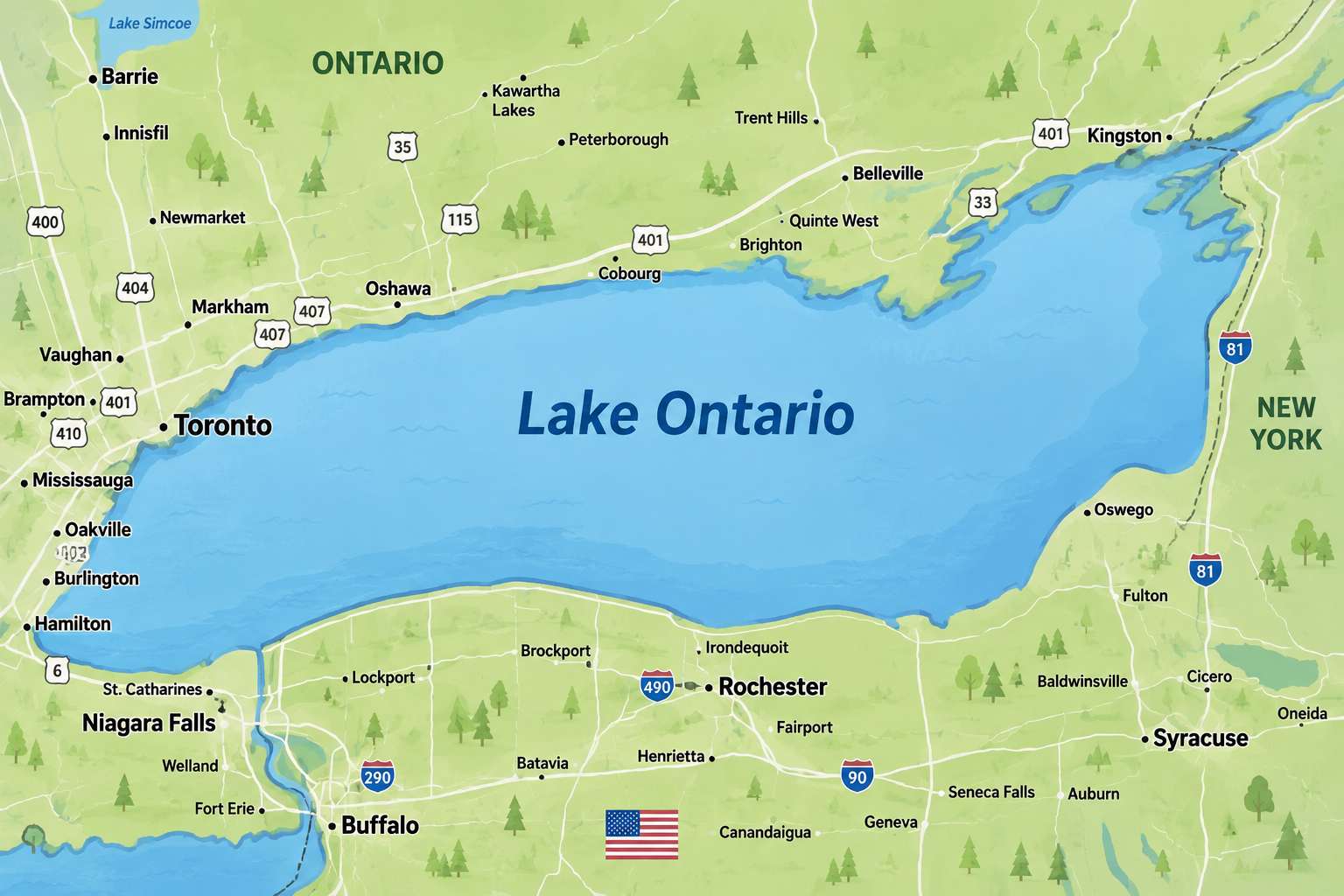
Key Takeaways
- Google Maps users in the United States now see “Lake America” after the U.S. Geographic Names Information System formally changed the lake's name.
- Canadian users continue to see “Lake Ontario.” Users outside Canada and the U.S. will see both names.
- President Donald Trump signed an executive order on August 27, 2026, directing the U.S. government to rename Lake Ontario as Lake America.
Open Google Maps in Toronto and look toward the giant body of water sitting beside the city. Nothing appears unusual.
It still says Lake Ontario.
Cross the border into the United States, open the same service and look at the same lake, however, and Google Maps now gives you a different answer:
Lake America.
And if you are looking at the lake from somewhere outside Canada and the United States, Google says you will see both names.
That unusual geographic split is now real after Google confirmed that it has changed the way Lake Ontario is labelled on Maps following a new U.S. government naming decision. (blog.google)
Yes, Google Really Changed the Map
Google confirmed the change on August 29.
The company said the U.S. Geographic Names Information System (GNIS) has formally changed the American name from Lake Ontario to Lake America.
Google's explanation is fairly straightforward: Maps generally follows official government geographic-name databases.
That produces an unusual situation where the name displayed depends on where the person looking at the map is located.
| Google Maps user location | Name displayed |
|---|---|
| 🇨🇦 Canada | Lake Ontario |
| 🇺🇸 United States | Lake America |
| 🌍 Other countries | Both names |
Google specifically confirmed all three treatments. (blog.google)
Read Google's official Maps announcement
How Did Lake Ontario Suddenly Become “Lake America”?
The story started before Google's map changed.
On August 27, U.S. President Donald Trump signed an executive order titled “Honoring the American History of the Great Lakes and Renaming Lake Ontario as Lake America.”
The order directs the U.S. Secretary of the Interior, working with the Board on Geographic Names, to take the steps necessary to use Lake America as the lake's name within the U.S. federal geographic naming system.
It also directs federal government maps, documents and communications to reflect the new name. (whitehouse.gov)
The White House's argument is that the lake has played an important role in American commerce, defence, energy and transportation and remains economically important to the United States.
But there is an enormous complication.
The lake isn't entirely American.
Canada Doesn't Suddenly Have a “Lake America”
Lake Ontario forms part of the international boundary between Canada and the United States.
So an American executive order does not mean Canada has renamed Lake Ontario.
And that distinction matters.
The U.S. government can determine the terminology its own federal agencies use. It cannot simply require the Canadian government to adopt the same geographic name.
That is exactly why Canadians opening Google Maps still see:
Lake Ontario.
Google isn't presenting the U.S. government's decision as a universal renaming of the lake. Instead, its map is adapting the label geographically according to the official naming sources it uses.
Imagine Standing on Opposite Sides of the Same Lake
This is where the story becomes particularly strange.
Imagine two people looking across Lake Ontario.
One is in Ontario.
The other is across the border in New York.
Both pull out their phones.
Both open Google Maps.
Both zoom in on exactly the same body of water.
The Canadian phone can say:
Lake Ontario.
The American phone can say:
Lake America.
And someone checking from Britain, India or Australia could be presented with both names.
The geography hasn't changed.
The water hasn't changed.
The international border hasn't moved.
Only the digital label has.
Why Would Google Follow the U.S. Decision?
Google has dealt with almost exactly this issue before.
Following the U.S. government's 2025 change from Gulf of Mexico to Gulf of America in its official geographic naming system, Google adopted a similar location-dependent approach.
People using Maps in the United States were shown Gulf of America; users in Mexico continued seeing Gulf of Mexico; people elsewhere saw both names.
So the Lake Ontario decision is not an entirely new Google policy created for this dispute.
It's another application of an existing Maps practice.
Google says that for U.S. geographic names, it follows changes made through GNIS. Once that database formally changed Lake Ontario to Lake America, Google followed it for U.S. users.
But Not Every Map Has Followed Google
Here's another interesting wrinkle.
As of August 30, Google Maps and Apple Maps were not displaying the lake the same way.
An Axios check found Google displaying Lake America, while Apple Maps continued displaying Lake Ontario.
That means the name you see can currently depend not only on which country you're in, but also on which mapping service you're using.
This may change as mapping databases are updated, but it illustrates something increasingly important about digital maps: what appears to be a simple geographic label can actually reflect government databases, company policies and international disagreements.
Does This Mean “Lake Ontario” Is Gone?
No.
For Canadians, Lake Ontario remains Lake Ontario, and Google Maps continues displaying that name in Canada.
The U.S. executive order changes how the American federal government identifies the lake. Google's decision then reflects that U.S. government designation for people using Maps in the United States.
It doesn't create an internationally binding name for the entire lake.
In fact, Google's decision to show different labels in different countries effectively acknowledges that disagreement.
TwikUp Insight
This story isn't really about Google deciding that one name is correct and another is wrong.
It's about what happens when the same physical place has competing official names.
Paper maps once made these disputes relatively invisible. A Canadian atlas could print one name and an American atlas another.
Digital maps are different.
Millions of people now look at what appears to be one global map — but underneath it, the information can change according to location.
Lake Ontario has become a remarkably clear example.
A Canadian and an American can now stand on opposite sides of the same water, open the same Google Maps app and see two different names for the same lake.
And for now, at least, the lake Canadians have known as Lake Ontario isn't disappearing from their screens.